View navigation
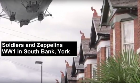 This is our latest walk, based on the research we carried out in our Heritage Lottery funded project about WW1. That project finished in 2017, but the results of our research are available on our website here. We invite you to think about how World War 1 impacted upon our area of York, South Bank.
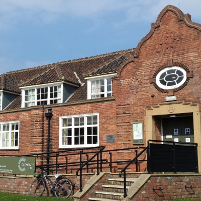
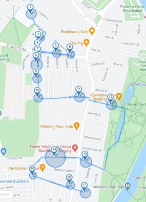 It is a linear walk, which should take about an hour to an hour and a half. It starts outside Clements Hall on Nunthorpe Road, and finishes at Beresford Terrace, off Bishopthorpe Road, where it is a short walk to the shops and cafes on Bishy Road, as it is known.
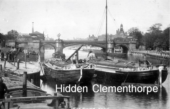 This walk uncovers the history of Clementhorpe, just outside the York City Walls and along the west bank of the River Ouse.
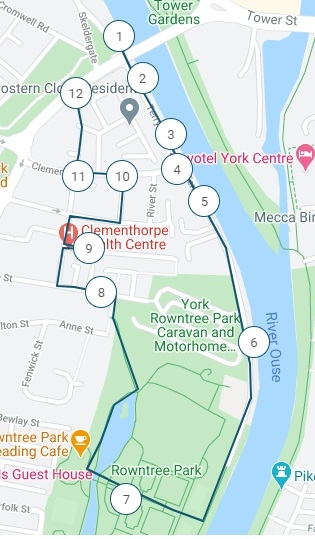 During the eighteenth and nineteenth centuries the area supported a wide variety of industries, including shipbuilding, glass making, malting and brewing, tanning, dying and thread making, manufacture of fertilisers, ropes, nails, ironwork and confectionery. The river was lined with busy wharves, and horses were everywhere.
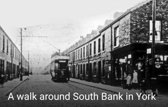 The walk draws upon material from our book Shadows in the Bricks: the old shops of South Bank in York. We try to paint a picture of life 100 years ago, and discover the surprising roots of local clubs, schools and churches. Did you know about the trams in South Bank and how they shaped our neighbourhood? You’ll hear about two local mansions and then how housing for artisans was first built in the late 19th century. There is the devastating damage to the area caused by two World Wars, including an eye-witness account from 1916. We look at the reputed site of a 15th century beheading. We notice the distinctive alleyways and talk about a surprising local link to the history of lupins. The temperance movement played a large part in shaping our area, so we look at local pubs. We can also reveal more about the famous Count de Burgh.
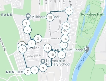 The walk takes around an hour and a half. It starts at the top of Ovington Terrace, where it meets Philadelphia Terrace, and finishes in Nunthorpe Grove. There are benches in second half of the walk. You can park along Ovington Terrace, and it's a short walk back from the end of the walk in Nunthorpe Grove to the Terrace.
 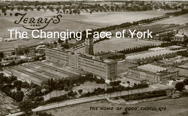 This walk explores the southern stretch of the River Ouse in York. It considers the impact of the river on the development of the City, the redevelopment of the iconic Terry’s Chocolate Works, and the importance of horse racing. It is full of variety, and includes elements of geography and geology as well as much about the history of the area.
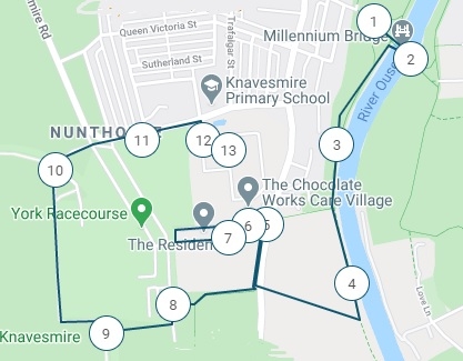 Perhaps the best place for a drink and something to eat (after lockdown) is the Winning Post on Bishopthorpe Road (just a couple of hundred metres north of the junction with Campleshon Road).
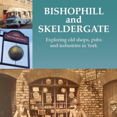
 This walk goes along the northern end of Bishopthorpe Road, as it approaches the city walls. It is based on our book Bishy Road: a York shopping street in time.
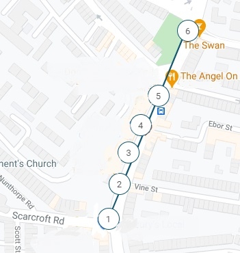 The walk takes you along the street today, showing you how retail trading has changed over the last 100 years and highlighting some fascinating stories. It starts on the corner of Scarcroft Road and Bishopthorpe Road.
InstructionsThis app can be used on iPhone and most Android phones. (Unfortunately it may not be available for some Huawei phones because of the Google issue).You will first need to download the free app onto your smartphone - go to Google Play Store/ iPhone App Store and find izi.travel to do this.When it's installed, select All Around Me. It will then ask you to allow it to track your location. If you're using an iPhone you may need to open and click on the Search field near the top of the screen first.You should then see our walks as an option. Click on one for our contents screen.Are you at the starting point? If you are, then press Play Audio for the introduction. You can also use this part of the commentary to adjust the sound on your phone if you wish.Then press the StartThen all you have to do is walk. Listen to the commentary and take time to look at the images which appear for a particular location. Tap on a photo to look at it and then swipe across for more. You can also read the notes if you wish, as they reflect the commentary.
If you’re using the app on location, when you've visited a feature it will change on the map from a number to a blue 'tick'. If you want to revisit any, then you need to 'reset' the walk, as they won't play again automatically while you're out and about.To do this on an Android phone, go back to the start page for the walk and click on the three red dots in the top right hand corner - press reset.On an iPhone, go to the home page of the app and look to the bottom of the screen. Tap My Profile > Preferences > Cache Settings > Tap Clear Visiting History and then tap Reset Cache and allow the app to clear all data and to relaunch.When you're listening to an audio clip, it is possible to use the control bar lower down on your screen, to stop and start. This may change the bar at the top to red, indicating you are no longer in 'auto' mode. Just tap again to go back to 'auto'. (If you are still in 'manual mode' and walking, the next clip will not play automatically.) |
|