Clements Hall
Nunnery Lane book cover

Clements Hall Local History Group

Exploring the Scarcroft, Clementhorpe, South Bank and Bishophill areas of York

Clements Hall Local History Group

Exploring the Scarcroft, Clementhorpe, South Bank and Bishophill areas of York

View navigation

Protecting our heritage

It is perhaps surprising how much of Clementhorpe’s industrial history can still be traced, albeit one has to look quite carefully. Steps have been taken to protect some of the more interesting relics.

Listed Buildings

Apart from Clementhorpe Malthouse, seven other buildings have been Listed by Historic England in recognition of their historic and/or architectural interest. These are The Swan, public house, and numbers 1, 3 to 7 Bishopgate Street. Number 7 was built around 1830; numbers 3-6 around 1830-35, and number 3 around 1860. With the exception of Number 1, which is now an office, they are all still in residential use. The Swan received its Listing mainly because it retains much of its original layout, dating back to the mid nineteenth century. The interior was remodelled in 1936 by Leeds architects Kitson, Parish, Ledgard & Pyman for the Tetley brewery company. The Listing states that The Swan has served as a beer house since 1861, and that it retains many of its 1936 interior features.

Conservation Area

The path along the western bank of the River Ouse through Clementhorpe is covered by Conservation Area No. 6 New Walk/Terry Avenue. This was designated in 1975. It covers the stretch of Terry Avenue from Skeldergate Bridge south to Millennium Bridge. Described as a popular, tree-lined recreational route along the River. Of interest here is the fact that it links the old and new Terry’s factory sites – now both redeveloped for housing – and preserves the name of the area’s premier employer.

P1030859

The view north along Terry Avenue. Rowntree Park on the left; River Ouse on the right. (Photo by John Stevens, June 2018)

Archaeology

The City Centre 'Area of Archaeological Importance' (AAI) under Part 2 of the 1979 Ancient Monuments and Archaeological Areas Act. Covers the whole of Clementhorpe from Skeldergate Postern to the northern edge of Rowntree Park, and westwards including the south side of Vine Street. It also includes Bishopthorpe Road and points west. Any planned developments in this area must have an appropriate level of archaeological investigation, and the reports are a valuable source of industrial history.

Other historic features

City of York Historic Characterisation Project, 2013 Character Area Statement 71 covers Clementhorpe and Bishopthorpe Road. The report provides a brief background history of the local environment. It suggests that we should look out for some Victorian ironwork, including lampposts. The ground is worth a look too. Stable Paviour paving – blue-grey patterned bricks are still widespread throughout the area in back and side lanes and gutters. Riven English Pennine Sandstone was used for several footpaths, for example on Cherry Hill Lane.

P1030887

Above: Stable paviours are widespread in Clementhorpe.

 Below: Boot scrapers can still be spotted. This one is in Vine Street.

 (Photos by John Stevens, June and September 2018)

P1030986

The street pattern

We have already seen how Bishopgate Street, Bishopthorpe Road and Clementhorpe were old-established routes.

P1030655
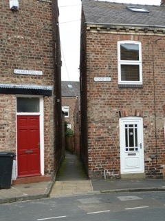
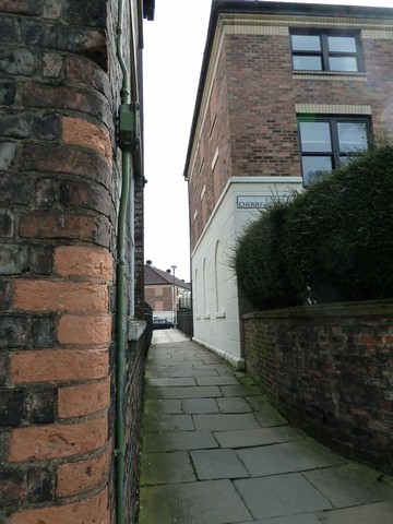
Cherry Hill is also interesting. It was a narrow lane leading from Bishopgate Street to Clementhorpe. Possibly named after the nearby cherry orchard, it was only really developed after 1830, but can still be traced today.

This is the northern end of the ancient trackway followed by Cherry Hill Lane. It may have linked Skeldergate Postern to the windmill on Bishopthorpe Road. Bishopgate House is on the left. To the right is an offshoot of the Postern development. The latter was built on the footprint of a modern warehouse extension of the Hargreaves Fertiliser works. (Photo by John Stevens, April 2018)

P1040151

The Clementhorpe ‘Snickelway’* as viewed from the City wall (Photo by John Stevens, September 2018).  *Coined by Mark W. Jones, A Walk around the Snickelways, 1983).

P1030640

This is the southern entrance to the Cherry Hill Lane pathway on Ebor Street. (Photo by John Stevens, April 2018)

Rivers, floods, banks and bridges

Clementhorpe Slip 2 - Copy

The wharves were once a vital link for local businesses bringing raw materials in and taking finished products out. (Photo: Hugh Murray, date unknown).

P1030982

Today, the wharves that once provided moorings for transport vessels, are used by house-boats. (Photo by John Stevens, September 2018)

P1030651

Flooding by the River Ouse has been a regular occurrence in Clementhorpe throughout history. Reports suggest that it made the loading and unloading of goods a bit risky! Before the construction of Naburn Lock and Weir in 1757 the River was also tidal. This photo was taken during the flood of March 2018. (Photo by John Stevens)

It was not only the Ouse that had a flooding problem. Throughout the late nineteenth century there are numerous references to the problems caused by flooding and pollution of the Clementhorpe Beck. This is the stream that now runs south through Rowntree Park, mainly in a culvert. On 6 September 1892, for example, the York Herald reported that the Clementhorpe Confectionery Company should be shown consideration on account of the Beck. The Beck was capable of flooding the company’s premises, but it was also used as an occasional dumping ground by the factory.

The need for a third bridge over the River Ouse was identified and The York (Skeldergate Bridge) Improvement Act was passed in 1875. The foundation stone of the new bridge was laid in 1878. Designed by Thomas Page, later succeeded by his son George, the bridge officially opened for pedestrians in January 1881 and to general traffic in March.

It is an iron bridge with Gothic details. The parapet is decorated with ornate ironwork featuring trefoils, six-pointed stars and the white rose of York. The small arch at the east end had an opening portion to admit tall-masted ships. The Motor House also served as a toll house and accommodation for the toll keeper and his family. The bridge was last opened in 1975, and the Motor House is now a café.

Skeldergate Bridge was originally built as a toll bridge, but was formally declared toll-free on 1 April 1914[1]. The bridge and attached tollhouse is a Grade II listed building.

P1030869

P1030873

Inscription on Skeldergate Bridge marking its foundation in 1878. The panel reads: “ The Foundation Stone of this Bridge was laid 12th June 1878, by The Right Honourable William Varey Lord Mayor. John Bellerby, Sheriff * George Gordon Page, Esquire, Engineer.”

A panel on the opposite side reads: “This Bridge was first used by Foot Passengers on the 1 January 1881, and was formerly Opened to General Traffic on the 10 March 1881, by The Right Honourable John Stephenson Rowntree Lord Mayor. Richard Thompson, Esquire, Sheriff.” (Photos by John Stevens, June 2018)

P1030773
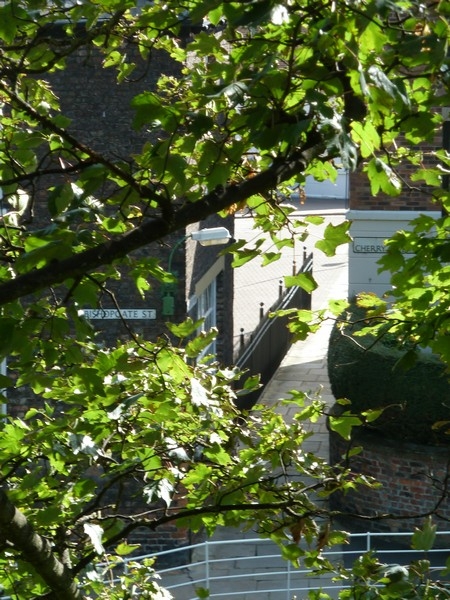
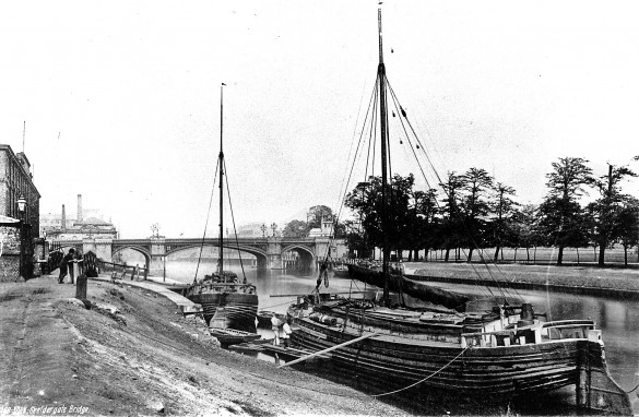
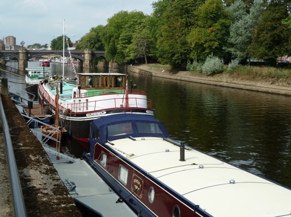
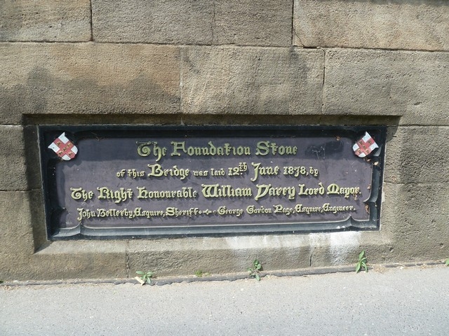
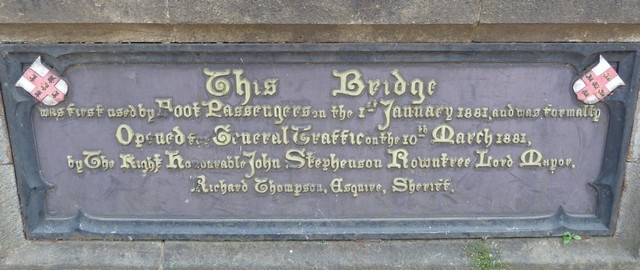
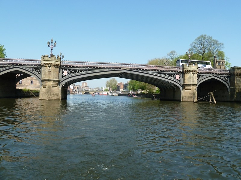
Skeldergate Bridge pictured from the water in 2018. The small right-hand span is the one that originally opened for water traffic (Photo by John Stevens, May 2018)

[1] York Museums Trust