
View navigation
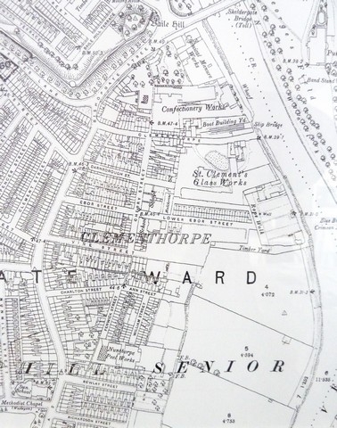 This map is based on the Ordnance Survey plan of 1892 (OS Crown Copyright Reserved). It shows Clementhorpe, perhaps nearing the peak of its industrial development. Key features including the River Ouse and the City Walls, with Baile Hill, enable us to locate it in relation to the rest of York – lying to the south and west of the City Centre.